
-
About
Introduce to the District
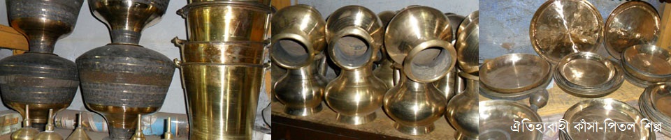
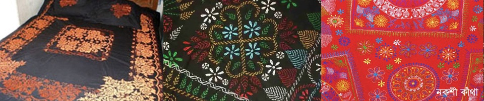
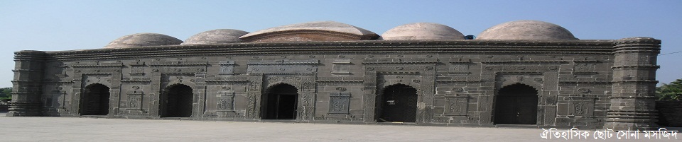
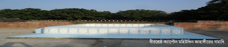
History-Tradition
Geographic & Economic
-
□Rivers
-
□Business and Commerce
-
□Communication System
-
□Hat-Bazar
-
□Restaurants and Hotels
-
□ Agricultural and non-agricultural khas land database
-
□Government closed water body of more than 20 acres
-
□Government closed water body of 20 acres
-
□Sairat Mahal (Inter Upazila Ferry Ghat, Mela, Balum Mahal, Ambagan)
-
□Rivers
-
Administration
Deputy Commissioner
DDLG/ADC
Officers & Staffs
About Sections
Resolutions of Meeting
DC Office
Important Information
-
□How to get what service
-
□ How to complain about the services of the district administration
-
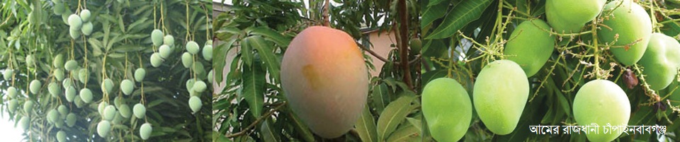
□Action plan for development of mango resources in Chapainawabganj
-
□Child Marriage Prevention Action Plan
-
□Day celebrated by the administration
-
□Namjari information
-
□Additional Deputy Commissioner (Revenue) Chapainawabganj Court pending Miss case information
-
□ Lease cases filed in the office of Deputy Commissioner, Chapainawabganj
-
□ Chapainawabganj district shelter project database
-
□Information Officer
-
□Photo Gallery
-
□Communication
-
Various publications by Deputy Commissioner, Chapainawabganj
Innovation Activities
Local Government Section-Important Information
-
□How to get what service
-
Govt. Offices
Security & Discipline Affairs
Education & Culture
Agriculture & Food
-
District Veterinary Hospital
-
□Agriculture Extension Dept.
-
□Dist. Food Controller Office
-
□District Fisheries Office
-
□District Livestocs Office
-
□BADC (Seeds)
-
□Dept. of Agricultural Marketing
-
□Laksha Research Center
-
□Regional Horticultural Research Center
-
□Horticulture Center
-
Seed Certification Agency
-
Soil Resource Development Institute Regional Office
-
Bangladesh Food Safety Authority
-
Plant Quarantine Station, Landport, Rohanpur, Chapainababgonj
-
Small Farmer Development Foundation, Regional Office, Chapainawabganj
-
Plant Quarantine Station, Landport, Sonamosjid, Chapainababgonj
-
District Artificial Insemination Centre.
Health
Engineering
Human Resources
Other Offices
More ...
Communication & Engineering
-
District Veterinary Hospital
-
Local Govt.
Chapainawabganj Municipality
District Council
-
□Background of District Council
-
□District Council Introduction
-
□Administrator, District Council
-
□Message from the District Council Administrator
-
□CEO
-
□Important projects
-
□Names of the Chief Executive Officers of the District Councils
-
□District Council Laws and Rules
-
□Former council chairmen
-
□Manpower
-
□Functions
-
□Organizational structure
-
□Citizen\'s Charter
-
District Council Chapainawabganj
Other
Shibganj Municipality
Rahanpur Municipality
Nachol Municipality
-
□Background of District Council
-
Other Institutions
Educational Institutions
Associations/Organizations
Non-governmental organizations
-
e-Services
National e-service
District e-service center
Union Digital Center
- Digital Bangladesh Award 2021
- Gallery
- Special initiative of district administration
মেনু নির্বাচন করুন
-
About
Introduce to the District
History-Tradition
Geographic & Economic
- □Rivers
- □Business and Commerce
- □Communication System
- □Hat-Bazar
- □Restaurants and Hotels
- □ Agricultural and non-agricultural khas land database
- □Government closed water body of more than 20 acres
- □Government closed water body of 20 acres
- □Sairat Mahal (Inter Upazila Ferry Ghat, Mela, Balum Mahal, Ambagan)
-
Administration
Deputy Commissioner
DDLG/ADC
Officers & Staffs
About Sections
Resolutions of Meeting
DC Office
Important Information
- □How to get what service
- □ How to complain about the services of the district administration
- □Action plan for development of mango resources in Chapainawabganj
- □Child Marriage Prevention Action Plan
- □Day celebrated by the administration
- □Namjari information
- □Additional Deputy Commissioner (Revenue) Chapainawabganj Court pending Miss case information
- □ Lease cases filed in the office of Deputy Commissioner, Chapainawabganj
- □ Chapainawabganj district shelter project database
- □Information Officer
- □Photo Gallery
- □Communication
- Various publications by Deputy Commissioner, Chapainawabganj
Innovation Activities
Local Government Section-Important Information
-
Govt. Offices
Security & Discipline Affairs
Education & Culture
Agriculture & Food
- District Veterinary Hospital
- □Agriculture Extension Dept.
- □Dist. Food Controller Office
- □District Fisheries Office
- □District Livestocs Office
- □BADC (Seeds)
- □Dept. of Agricultural Marketing
- □Laksha Research Center
- □Regional Horticultural Research Center
- □Horticulture Center
- Seed Certification Agency
- Soil Resource Development Institute Regional Office
- Bangladesh Food Safety Authority
- Plant Quarantine Station, Landport, Rohanpur, Chapainababgonj
- Small Farmer Development Foundation, Regional Office, Chapainawabganj
- Plant Quarantine Station, Landport, Sonamosjid, Chapainababgonj
- District Artificial Insemination Centre.
Health
Engineering
Human Resources
Other Offices
More ...
Communication & Engineering
-
Local Govt.
Chapainawabganj Municipality
District Council
- □Background of District Council
- □District Council Introduction
- □Administrator, District Council
- □Message from the District Council Administrator
- □CEO
- □Important projects
- □Names of the Chief Executive Officers of the District Councils
- □District Council Laws and Rules
- □Former council chairmen
- □Manpower
- □Functions
- □Organizational structure
- □Citizen\'s Charter
- District Council Chapainawabganj
Other
Shibganj Municipality
Rahanpur Municipality
Nachol Municipality
-
Other Institutions
Educational Institutions
Associations/Organizations
Non-governmental organizations
-
e-Services
National e-service
District e-service center
Union Digital Center
- Digital Bangladesh Award 2021
-
Gallery
Photo Gallery
Videos Gallery
-
Special initiative of district administration
innovative initiatives of the district administration
Activities of district administration
Various publications of the district administration
Main Comtent Skiped
Geographical introduction:
Location:
Chapainawabganj is on the far west of the map of Bangladesh. Rajshahi and Naogaon districts on the east, Malda district of West Bengal in the north, Padma river and Malda district on the west and Padma river and Murshidabad district (West Bengal) on the south. Chapainawabganj district is located at 24'22 'to 24'56' north latitude and 87'55 'to 88'23' east longitude.
Topographically chapainawabgonj is divided into two parts.
Such as 1. Barind region and
2. Diar region.
1. Barind region:
The area on the east side of the river Mahananda is known as Barind region. The Barind region is one of the oldest areas of Bangladesh and the subcontinent. The Barind region is thought to have formed in the early stages of the formation of the Bengal Delta. Chapainawabganj Sadar, some parts of Gomstapur upazila and the whole area of Nachol upazila belong to Barind area. Paddy is the main crop of the Barind region.
2. Diar region:
The area west of the river Mahananda is known as Diar. This region is formed as a result of the constant change of course of the river Ganges. The land of this riverine area is very fertile. Once upon a time this area was famous for the production of silk and indigo. At present most of the mango orchards of the district are located in Diar area.
Rivers and wetlands:
1. The river Padma-Ganga flows through India and enters Bangladesh under the name of Padma by the side of Shibganj upazila of Chapainawabganj. Since the construction of the Farakka Dam upstream, the flow of water in the Padma has been declining and huge chars have been rising. At present the Padma has lost its former form but every year during the monsoon season it assumes a catastrophic form.
2. Mahananda: The river Mahananda enters Bangladesh through Bholahat upazila of the district and joins the Padma at Godagari upazila of Rajshahi. Chapainawabganj district town is located on the banks of the river Mahananda.
3.Pagla: The river Pagla, which came from India, joins the Maraganga at Tattipur in Shibganj upazila and flows into Mahananda a little further.
4.Punarbhaba: The river Punarbhaba flows from Dinajpur through Naogaon district through Gomstapur upazila of Chapainawabganj.
Beel and Marshland:
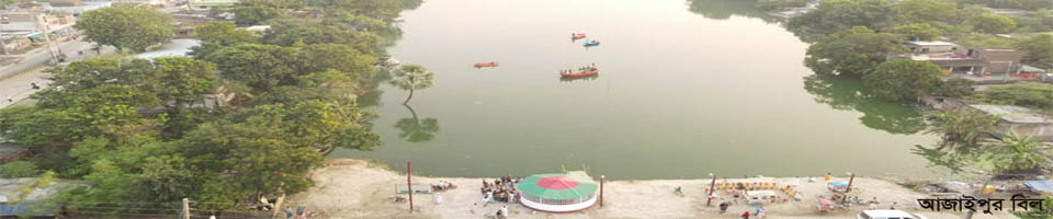
In addition to rivers, the district has numerous beels and wetlands like Bilbhatia, Beel Churil, Beel Singra, Beel Hogla, Beel Putimari, Beel Anil and Beel Marichadah and Beel Kumiradah.
Temperature:
he maximum and minimum average temperatures here are 44 degrees Celsius and 44degrees Celsius respectively. Annual average rainfall is 187cm


Site was last updated:
2024-05-16 16:45:09
Planning and Implementation: Cabinet Division, A2I, BCC, DoICT and BASIS
Technical Assistance:
![]()
Developed By: